Add your own picture and explain the route, parking, gates, paths or landmarks that help people find it.
Earn 5 points after the picture is checked and accepted.
Add your photo and local directionsShare what you foundWhat is recorded here
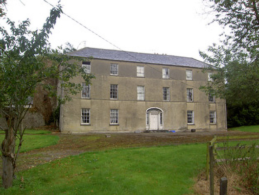
Detached six-bay three-storey country house, built c. 1800, with slightly lower three-storey stairs return to rear, flanked by two-storey block at west end of rear, parallel to axis of main block, and similar height three-storey block at right angles to east end of rear. Single-and two-bay single- and two-storey extensions to latter blocks and to north-east corner of main block. Slate roofs throughout, hipped to main block, pitched to three-storey rear block, lean-to to two-storey block and to extensions, with cast-iron rainwater goods and rendered chimneystacks. Roughcast rendered walls, front elevation having render plinth and edging and smooth rendered string courses at upper floor sill levels. Square-headed window openings with limestone sills, having six-over-three pane timber sliding sash windows to top floor and six-over-six pane to lower floors. Round-headed openings to stairs return, with six-over-six pane timber sliding sash windows. West rear block has tripartite nine-over-six pane timber sliding sash windows. East rear block has eight-over-four pane window to top floor and twelve-over-eight pane to first floor. Elliptical-headed door opening comprising timber panelled door flanked by timber engaged columns and paned sidelights, and surmounted by spoked fanlight, approached by cut limestone steps. L-plan outbuilding to north-west, having re-entrant corner and integral carriageway through eastern range. Pitched slate roofs with cast-iron rainwater goods, with ashlar limestone bellcote to northern range. Random rubble limestone walls with tooled limestone quoins, and tooled limestone voussoirs to openings. Elliptical-arched opening to north block having alternating tooled limestone and possibly Churchtown marble voussoirs, with date inscribed on keystone. Cut tooled limestone gate piers to south entrance of yard. Random rubble limestone walled garden to west of site, having elliptical-headed entrance with tooled cut limestone voussoirs to east wall. Painted stone piers with decorative wrought-iron double-leaf and pedestrian gates set in pebbledash walls with painted cut-stone coping to south-west of site.
This official record and map point do not grant access. Most recorded buildings are privately owned; view them only from public ground unless the owner allows entry.