Add your own picture and explain the route, parking, gates, paths or landmarks that help people find it.
Earn 5 points after the picture is checked and accepted.
Add your photo and local directionsShare what you foundWhat is recorded here
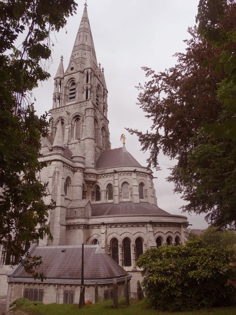
St Finbar's Cathedral, c. 1870, architect William Burges. In 1862 Burges prepared plans for the Cathedral, foundation was laid in 1865, church consecrated in 1870, towers and spires completed in 1876. The cost of completion exceeded £100,000, despite the original specification that it not exceed £15,000.The Cathedral is stylistically late thirteenth century pointed Gothic, is cruciform in shape and consists of a nave 162 feet long, width of the aisles 81 feet 6 inches, width of nave 27 feet 6 inches. The Cathedral has triple spires, triple portals to the west elevation, and an abundance of external stone carved detail. Cork limestone was used throughout. The thirteen Masonic Lodges around the city of Cork presented the sculptural representations of the four winged beasts of the Revelations which are placed around the rose window to the west elevation. Burges also designed stained glass, sculptures, mosaics, furniture and metal work for the interior. High columns are Bath stone while the walls are lined with Cork red marble. Scenes from the old Testament are depicted in the stained glass. Bells hang in the north tower, cast in Gloucestershire in 1751. Chapter house added 1915. Enclosed island site.
This official record and map point do not grant access. Most recorded buildings are privately owned; view them only from public ground unless the owner allows entry.