Add your own picture and explain the route, parking, gates, paths or landmarks that help people find it.
Earn 5 points after the picture is checked and accepted.
Add your photo and local directionsShare what you foundWhat is recorded here
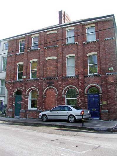
Terraced two-bay three-storey former house, adapted 1895, as a pair with the adjoining former house to the south. Comprising of recessed bay to the north, projecting bay to the south, and having shared blind-bay with the adjoining house. Chamfered corner to the north. Now in use as flats and offices. Hipped slate roof with red brick chimneystack and yellow brick eaves corbels. Red brick walls having red brick pilasters, yellow brick dressings to openings, and limestone string courses having yellow brick corbels. Round-headed openings to ground floor and segmental-arched openings to upper floors, having timber sliding sash windows. Replacement timber panelled door and fanlight, with limestone step. Retaining interior features.
This official record and map point do not grant access. Most recorded buildings are privately owned; view them only from public ground unless the owner allows entry.