Add your own picture and explain the route, parking, gates, paths or landmarks that help people find it.
Earn 5 points after the picture is checked and accepted.
Add your photo and local directionsShare what you foundWhat is recorded here
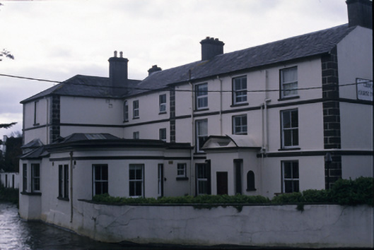
Detached irregular-plan multiple-bay three-storey building of three periods, commenced c. 1780. Originally built as house, later used as clubhouse. Comprising three-bay three-storey main block with adjoining two-bay three-storey block, having wing set at right angle to main elevation, and with mid nineteenth century bow-fronted extension to river side elevation. Pitched and hipped slate roofs with rendered chimneystacks. Rendered walls with string course and quoins. Heavy cornice and frieze around bow fronted extension. Entrance porch to main block comprising Ionic columns set in chamfered corners with broken pediment above. Pair of bay windows to river elevation. Timber sliding sash and some replacement aluminium windows. Retaining interior features.
This official record and map point do not grant access. Most recorded buildings are privately owned; view them only from public ground unless the owner allows entry.