Add your own picture and explain the route, parking, gates, paths or landmarks that help people find it.
Earn 5 points after the picture is checked and accepted.
Add your photo and local directionsShare what you foundWhat is recorded here
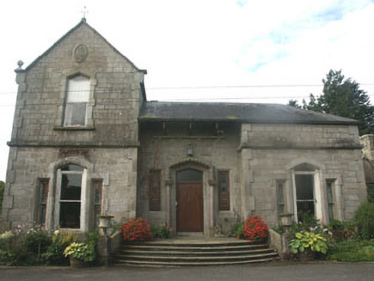
Detached three-bay two, one and a half, and single-storey eclectically styled country house, built in 1864 to designs by W.F. Caldbeck, partly demolished after a fire in 1922, with the remaining sections restored in 1973. The building is roughly L-shaped in plan with a part two, part single-storey wing to north and a two-storey wing to the east, whilst to the south is a largely one and a half-storey wing, part of which (to the east end) has been demolished. The north wing appears to have been originally wholly two-storey, its western end partly demolished. The overall styling of the building is vaguely Tudoresque with various corbelled gables and some pointed arch windows, however the detailing is somewhat eclectic. The walls are in squared granite with dressed granite quoins, surrounds to the openings, eaves brackets, decorative finials and heraldic panels. The gable-ended pitched roof is slated and has granite chimneystacks and parapets. The entrance is to the north elevation and consists of a replacement panelled timber door and pointed arch fanlight, with a surround made up of marble three-quarter colonettes with floral capitals and a dentilled archivolt. The window openings have a mixture of shallow pointed arch and segmental heads and are filled with one over one timber sash or replacement fixed light timber frames. Cast-iron rainwater goods. The property is set within extensive grounds.
This official record and map point do not grant access. Most recorded buildings are privately owned; view them only from public ground unless the owner allows entry.