Add your own picture and explain the route, parking, gates, paths or landmarks that help people find it.
Earn 5 points after the picture is checked and accepted.
Add your photo and local directionsShare what you foundWhat is recorded here
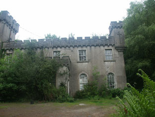
Detached five-bay two-storey former barracks with single-bay three-stage tower, built 1804 but with large sections to both the north and south demolished c.1860 and the remainder remodelled in romantic castle style for use as a house. The building now consists of a main rectangular section with the off-set tower to the north, porch projection to the west front, lean-to projections to the rear and a bartizan to the south-west. The façade is finished in unpainted lined render with granite dressings to the openings, whilst the rear is finished in roughcast. The front elevation of the main section, the tower, porch and the bartizan have corbelled crenellated parapets. The pitched roof of the main section is slated and has rendered chimneystacks, however the roofs of the porch, tower and bartizan are all hidden by their respective parapets. The entrance is to the south face of the porch and consists of a panelled timber door (reached via a short flight of stone steps). The windows are a mixture of semi-circular and flat-headed with eleven over six and six over six timber sash frames. Cast-iron rainwater goods. The building is set on a well wooded rise at the end of a long narrow lane with its large grounds enclosed by a tall rubble wall, now largely obscured by trees. The grounds, which are entered through an elliptical-arched gateway to the west, include the remains of a yard with outbuildings (to the east of the house).
This official record and map point do not grant access. Most recorded buildings are privately owned; view them only from public ground unless the owner allows entry.