Add your own picture and explain the route, parking, gates, paths or landmarks that help people find it.
Earn 5 points after the picture is checked and accepted.
Add your photo and local directionsShare what you foundWhat is recorded here
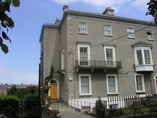
End-of-terrace three-bay three-storey over basement house, built in 1859 as part of a planned, part-terraced, part semi-detached development of ten similarly styled properties. To the west elevation is a two-bay full-height projection. The façade is finished in unpainted roughcast, painted plain render to the basement level, granite quoins, parapet with projecting eaves course, and moulded surrounds to many of the openings. The slated hipped roof is largely hidden from view behind the parapet and has rendered chimneystacks with corbelling. The entrance is to the south elevation of the west projection and consists of a panelled timber door and semi-circular fanlight encased with a moulded surround; it is reached via a flight of stone steps with relatively plain cast-iron railings. In general, the windows are flat-headed with two over two timber sash frames, however the basement windows have replacement timber frames. Most of the ground and first floor windows have relatively plain moulded surrounds, with projecting hood mouldings to those on the latter floor. There is a decorative wrought-iron balcony to the first floor of the front elevation, however the smaller balcony to the west elevation has been removed. Cast-iron rainwater goods. The building faces onto a road but is separated from it by a relatively large garden enclosed by decorative cast-iron railings with matching gate.
This official record and map point do not grant access. Most recorded buildings are privately owned; view them only from public ground unless the owner allows entry.