Add your own picture and explain the route, parking, gates, paths or landmarks that help people find it.
Earn 5 points after the picture is checked and accepted.
Add your photo and local directionsShare what you foundWhat is recorded here
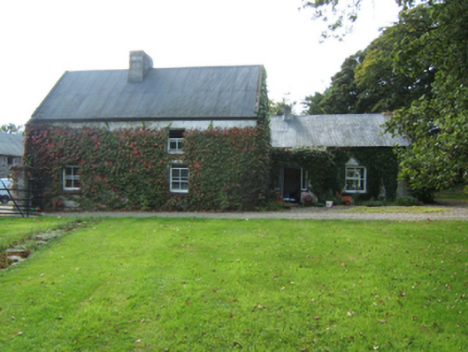
Detached two-bay single-storey part double-pile farmhouse with half-dormer attic, extant 1653, on an L-shaped plan originally two-bay single-storey part double-pile on a T-shaped plan; four-bay single-storey rear (south) elevation originally six-bay single-storey. Occupied, 1901; 1911. Pitched part double-pile (M-profile) corrugated-iron roof with pressed iron ridges, roughcast off-central chimney stack having paired stringcourses below capping, lichen-spotted concrete or rendered coping to gables, and cast-iron rainwater goods on timber eaves boards. Creeper- or ivy-covered limewashed battered walls. Square-headed window openings with creeper- or ivy-covered sills, and concealed dressings framing two-over-two timber sash windows with one-over-one timber sash windows to gables to side elevations. Square-headed window openings to rear (south) elevation with concealed dressings framing timber casement windows. Set in landscaped grounds with rendered piers to perimeter having shallow pyramidal capping supporting wrought iron double gates.
This official record and map point do not grant access. Most recorded buildings are privately owned; view them only from public ground unless the owner allows entry.