Add your own picture and explain the route, parking, gates, paths or landmarks that help people find it.
Earn 5 points after the picture is checked and accepted.
Add your photo and local directionsShare what you foundWhat is recorded here
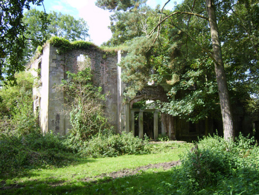
Detached three-bay (two-bay deep) two-storey over basement country house, extant 1839, on a rectangular plan centred on single-bay full-height breakfront originally with (single-storey) prostyle tetrastyle Ionic portico to ground floor; four-bay two-storey rear (west) elevation. Occupied, 1901. Leased, 1911. Sold, 1912. Burnt, 1921. Now in ruins. Roof now missing. Creeper- or ivy-covered rendered, ruled and lined walls on moulded cushion course on overgrown plinth with rendered, ruled and lined monolithic pilasters to corners; rendered, ruled and lined surface finish (breakfront) with concealed cut-granite flush quoins to corners. Segmental-headed central door opening in tripartite arrangement originally behind (single-storey) prostyle tetrastyle Ionic portico approached by flight of four overgrown cut-granite steps, cut-granite doorcase with monolithic pilasters supporting ogee-detailed cornice on blind frieze, and concealed red brick block-and-start surround with no fittings surviving. Square-headed window openings (ground floor) with "guttae"-detailed cut-granite sills, and rendered surrounds with panelled pilasters supporting ogee-detailed pediments on scroll consoles. Square-headed window openings (first floor) with "guttae"-detailed cut-granite sills, and moulded surrounds with ogee-detailed hood mouldings on consoles. Interior in ruins. Set in wooded grounds.
This official record and map point do not grant access. Most recorded buildings are privately owned; view them only from public ground unless the owner allows entry.