Add your own picture and explain the route, parking, gates, paths or landmarks that help people find it.
Earn 5 points after the picture is checked and accepted.
Add your photo and local directionsShare what you foundWhat is recorded here
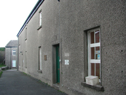
Detached six-bay two-storey soldier accommodation block or soldier barrack, extant 1840, on a symmetrical plan originally attached. Occupied, 1901. Vacant, 1911. Burnt, 1922. In ruins, 1933. Reconstructed, 1939. Vacated, 1986. Now in alternative use. Hipped slate roof with lichen-spotted concrete ridge tiles, rendered chimney stacks centred on rendered chimney stack having stepped capping supporting terracotta pots, and replacement uPVC rainwater goods on eaves boards on roughcast eaves. Roughcast walls on rendered plinth with rendered quoins to ends. Pair of square-headed door openings with cut-granite step thresholds, and rendered "bas-relief" surrounds centred on keystones framing glazed timber boarded double doors. Square-headed window openings with concrete sills, and concealed red brick block-and-start surrounds framing timber casement windows. Set in shared grounds including relandscaped parade ground.
This official record and map point do not grant access. Most recorded buildings are privately owned; view them only from public ground unless the owner allows entry.