Add your own picture and explain the route, parking, gates, paths or landmarks that help people find it.
Earn 5 points after the picture is checked and accepted.
Add your photo and local directionsShare what you foundWhat is recorded here
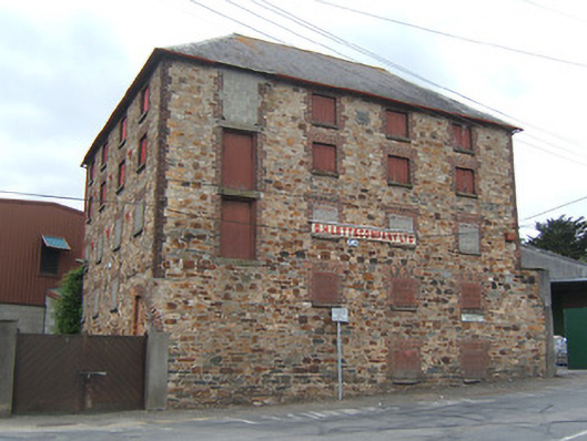
Detached four-bay five-storey malthouse, dated 1867, on an L-shaped plan with four-bay five-storey side elevations, and two-bay five-storey return to south-west. Now disused. Hipped slate roof on an L-shaped plan with clay ridge tiles, rolled lead ridges, slightly swept eaves, and cast-iron rainwater goods on stone-lined eaves having iron ties. Coursed random rubble stone walls with red brick quoins to corners, cast-iron tie plates to each floor, and cut-granite shield date stone/plaque to top floor. Square-headed window openings with cut-granite sills, red brick block-and-start surrounds incorporating voussoirs supporting red brick header bond courses, and timber boarded casement fittings (some now blocked-up with concrete block infill). Square-headed door openings including loading doors to upper floors with red brick block-and-start surrounds on or supporting cut-granite lintels, and tongue-and-groove timber panelled doors (some now blocked-up with concrete block infill). Street fronted [DS].
This official record and map point do not grant access. Most recorded buildings are privately owned; view them only from public ground unless the owner allows entry.