Add your own picture and explain the route, parking, gates, paths or landmarks that help people find it.
Earn 5 points after the picture is checked and accepted.
Add your photo and local directionsShare what you foundWhat is recorded here
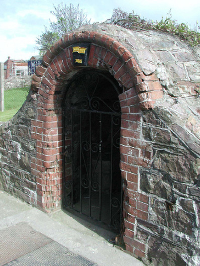
Freestanding single-bay single-stage well house, dated 1948, on a semi-circular plan. Now disused. Part creeper- or ivy-covered rubble stone domed roof. Part creeper- or ivy-covered coursed or snecked rubble stone walls. Round-headed opening with concrete threshold, and red brick block-and-start surround centred on embossed plate ("1948") with red brick header bond beaded hood moulding framing wrought iron gate. Street fronted with concrete footpath to front.
This official record and map point do not grant access. Most recorded buildings are privately owned; view them only from public ground unless the owner allows entry.