Add your own picture and explain the route, parking, gates, paths or landmarks that help people find it.
Earn 5 points after the picture is checked and accepted.
Add your photo and local directionsShare what you foundWhat is recorded here
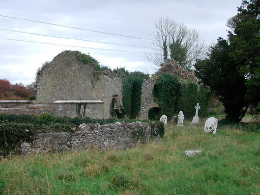
Graveyard on irregular rectilinear plan having cut stone gravestones dating from c.1620 to c.1890. Previously in use as a Church of Ireland burial site. Graveyard now overgrown and out of use. Associated with a ruinous hall-type church on rectangular plan, built c.1700, having rubble limestone walls and brick dressings to pointed-arched, square-headed and segmental-headed openings and originally with a pitched roof, now gone. Crypt beneath church with carved limestone plaque mounted on exterior east facing wall bearing coat of arms. Site enclosed by a rubble limestone wall with main entrance gates to the west side comprising a pair of rubble limestone gate piers on square-plan with dressed corner stones/quoins supporting a wrought-iron flat bar gate. Flight of cut stone steps and pedestrian entrance adjacent to the north. Located to the west of Tyrrellspass and adjacent to the southwest of a ruinous circular tower house.
This official record and map point do not grant access. Most recorded buildings are privately owned; view them only from public ground unless the owner allows entry.