Add your own picture and explain the route, parking, gates, paths or landmarks that help people find it.
Earn 5 points after the picture is checked and accepted.
Add your photo and local directionsShare what you foundWhat is recorded here
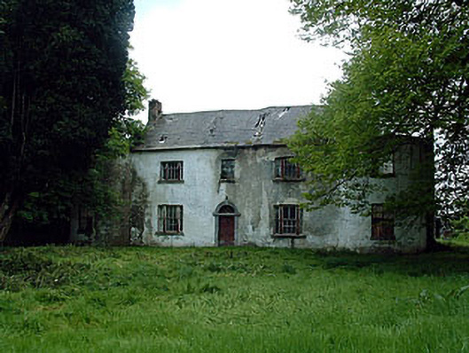
Detached three-bay two-storey house with attic level, rebuilt c.1815 incorporating the fabric of an earlier house/farmhouse built c.1740, having full-height single-bay bowed projections to either end of the front façade (north) and a stair return to the rear (south). Now derelict and out of use. Pitched natural slate roof, now partially collapsed, having (projecting) roughcast rendered brick chimneystacks to either gable end (east and west) of the main body of the building. Lime roughcast rendered walls with square-headed window openings having stone sills and the remains of Wyatt-style tripartite timber sash windows. Single three-over-six pane timber sliding sash window to the centre of the main façade at first floor level. Timber sliding sash windows to the full-height bowed projections. No windows to the rear façade apart from a single round-headed opening to the stair return having intersecting tracery to head. Central round-headed doorcase having a cut limestone surround with cut stone lintel and tooled keystone over, an early timber panelled door with octagon panels and a spoke/radial fanlight above. Set well back from road at the end of a long approach avenue from the north. Complex of outbuildings to the rear (south) having dressed and cut stone detailing. Former kitchen garden/walled garden on rectilinear-plan to the east. Located to the south of Milltownpass.
This official record and map point do not grant access. Most recorded buildings are privately owned; view them only from public ground unless the owner allows entry.