Add your own picture and explain the route, parking, gates, paths or landmarks that help people find it.
Earn 5 points after the picture is checked and accepted.
Add your photo and local directionsShare what you foundWhat is recorded here
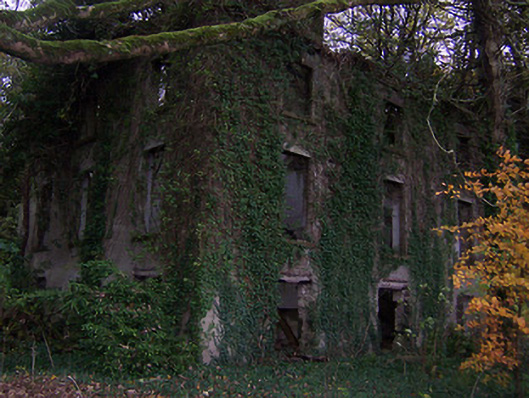
Detached five-bay two-storey over basement country house, built c.1815 and remodelled c.1860, having a two-storey service wing attached to the east side. Now in ruins and overgrown. Roof now gone, originally shallow hipped, with a central pair of chimneystacks and a moulded cut stone cornice to the eaves. Moulded cut stone plinth over basement. Constructed of coursed rubble stone with roughcast rendered finish over. Square-headed window openings with cut stone sills and dressed stone surrounds. A number of window openings retain cut stone scrolled brackets supporting entablatures over. Main entrance to the centre of the north elevation, originally having a porch with engaged columns. Set back from road in extensive mature grounds with a complex of outbuildings/stable block (15403306) to the northeast, main entrance gates to the west (15403305), The Cooper Mausoleum (15403304) to the south and sections estate wall (15402625) running around former demesne boundary. Located to the south of Mullingar and to the northwest of Rochfortbridge.
This official record and map point do not grant access. Most recorded buildings are privately owned; view them only from public ground unless the owner allows entry.