Add your own picture and explain the route, parking, gates, paths or landmarks that help people find it.
Earn 5 points after the picture is checked and accepted.
Add your photo and local directionsShare what you foundWhat is recorded here
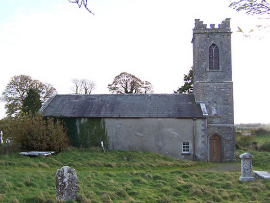
Freestanding Church of Ireland church, built c.1810, comprising three-bay hall with attached three-stage tower on square-plan to the west with a raised parapet with Irish-style crenellations. Pitched natural slate roof with raised limestone verges and cast-iron rainwater goods. Roughcast rendered walls to hall with limestone quoins to corners, tower constructed of rubble limestone with ashlar limestone detailing including quoins to corners, projecting string courses, and a cornice at parapet level. Pointed-arched window openings with timber Y-tracery to south elevation of nave, blank walls to north elevation of nave with only a square-headed window with a timber sash window and wrought-iron security bars to west end. Pointed segmental-headed doorcase to north face of tower with chamfered cut limestone surrounds and replacement timber double doors. Blind or infilled pointed-arch openings with cut stone surrounds and stone sills above to second stage of tower, pointed-arched openings above to belfry (third stage) with timber Y-tracery and timber louvered vents. Set back from the road in own grounds and surrounded by graveyard with mostly nineteenth century grave markers. Located on a low ridge a short distance to the northwest of the village of Horseleap. Church and graveyard occupy the site of a medieval abbey and is adjacent to a deserted medieval borough and a Motte and Bailey (east). The only extant evidence of the earlier abbey/church are the remains of a ruinous late medieval church, on rectangular plan, which is located to the east of the present church adjacent to the main entrance gates. A number of eighteenth century memorials to the interior of the present church were moved from this earlier church, including 'The Payton memorial', which commemorates George Payton who died in 1698.
This official record and map point do not grant access. Most recorded buildings are privately owned; view them only from public ground unless the owner allows entry.