Add your own picture and explain the route, parking, gates, paths or landmarks that help people find it.
Earn 5 points after the picture is checked and accepted.
Add your photo and local directionsShare what you foundWhat is recorded here
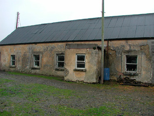
Detached five-bay single-storey house, built c.1820, with a single-bay flat-roofed entrance porch to main façade (east). Now out of use. Pitched corrugated metal roof with no chimneystacks surviving. Lime rendered walls, failing in places exposing rubble stone construction beneath to the south end and mud-walled construction to the north end. Porch constructed of brick with render over. Square-headed window openings with rendered surrounds, cut stone sills, cast-iron sill guards and one-over-one pane timber sliding sash windows. Square-headed doorcase to south face of porch with timber sheeted door. Set back from road at a right angle to the road alignment. Single-storey outbuilding to the north having pitched natural slate roof with raised verges to either end, roughcast rendered walls over rubble stone construction and square-headed openings with brick dressings and timber doors. Rubble limestone gate pier having wrought-iron gates gives access to house from the south. Cast-iron water pump and cut stone trough to forecourt to the east of the house with rubble limestone gates piers, circular in plan, supporting wrought-iron gates to the east. Located to the east of Gainestown Roman Catholic church (15402643) and to the southeast of Mullingar.
This official record and map point do not grant access. Most recorded buildings are privately owned; view them only from public ground unless the owner allows entry.