Add your own picture and explain the route, parking, gates, paths or landmarks that help people find it.
Earn 5 points after the picture is checked and accepted.
Add your photo and local directionsShare what you foundWhat is recorded here
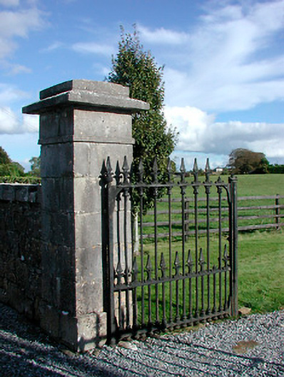
Former entrance gates serving Gaybrook House (now demolished), erected c.1790, comprising four ashlar limestone gate piers, on square-plan, with stepped pyramidal capstones over. Piers to either side (northeast and southwest) linked by sections of coursed rubble limestone walling with inner piers supporting cast-iron gates. Rubble limestone boundary walls run way to the south and the east. Three-bay single-storey former gate lodge to the south, now heavily altered. Located to the southeast of Mullingar and to the northwest of the site of Gaybrook House.
This official record and map point do not grant access. Most recorded buildings are privately owned; view them only from public ground unless the owner allows entry.