Add your own picture and explain the route, parking, gates, paths or landmarks that help people find it.
Earn 5 points after the picture is checked and accepted.
Add your photo and local directionsShare what you foundWhat is recorded here
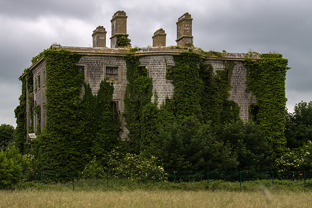
Detached seven-bay three-storey over basement country house, built c.1743, with projecting full-height bows to the centre of the west and east side elevations. Later return to rear (south). Later in use as a military hospital (1914-1919). Now out of use and a roofless overgrown shell. Shallow hipped natural slate roof, now collapsed, having a pair of cut limestone chimneystacks to the centre, aligned parallel with former roof ridge, having moulded ashlar cornices over. Constructed of ashlar limestone with extensive cut limestone detailing, including a heavy moulded eaves cornice, raised quoins to the corners and a string course at first floor level. Square-headed window openings, diminishing in size towards eaves, with moulded cut stone architraved surrounds and cut stone sills. Central round-headed pedimented tripartite Doric doorcase to south façade having four columns supporting entablature and pediment over. Fittings to all openings now gone. Round-headed niche flanked by Ionic pilasters over central doorcase at first floor level with a circular/oculus niche over to second floor having a scrolled console bracket to base. Interior now gutted but retaining some fragments of original plasterwork to ground floor walls. Located in extensive grounds on the western shores of Lough Ennell to the south of Mullingar. Remains of former outbuildings to the northeast and former main entrance gates and attendant gate lodge (15402616) to the east.
This official record and map point do not grant access. Most recorded buildings are privately owned; view them only from public ground unless the owner allows entry.