Add your own picture and explain the route, parking, gates, paths or landmarks that help people find it.
Earn 5 points after the picture is checked and accepted.
Add your photo and local directionsShare what you foundWhat is recorded here
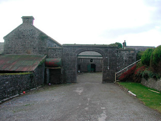
Extensive complex of multi-bay single and two-storey outbuildings associated with Dorrington House (now demolished), built c.1800 and greatly extended c.1850, comprising stables, original house extension, a piggery, milking shed and outbuildings, arranged around a number of courtyards, to the east of the site of Dorrington House. Pitched natural slate roofs, some with raised stone verges to the gable ends. Coursed dressed limestone rubble walls with brick dressings to openings and a number with dressed limestone quoins. Single-storey former piggery constructed of brick. Main entrance to the north comprising an integral segmental-headed carriage arch, built into a section of dressed limestone walling, with dressed limestone voussoirs to the arch and dressed limestone coping over. Square-headed window openings with brick dressings, cut stone sills containing louvered windows or timber sliding sashes, a number with iron security bars. Loop holes openings to upper floors of some ranges. Square-headed door openings with timber doors. Series of integral carriage arches with brick surrounds one having original timber door, those to rear of outbuildings retaining wrought-iron gates. Complex extends to southeast with stables, milking shed and storerooms having hipped natural slate roofs. Set back from road in extensive grounds with rubble limestone boundary wall and gate piers. Located to the east of Glassan.
This official record and map point do not grant access. Most recorded buildings are privately owned; view them only from public ground unless the owner allows entry.