Add your own picture and explain the route, parking, gates, paths or landmarks that help people find it.
Earn 5 points after the picture is checked and accepted.
Add your photo and local directionsShare what you foundWhat is recorded here
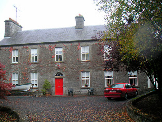
Detached six-bay two-storey house, dated 1779. Possibly containing the fabric of an earlier structure. Pitched natural slate roof having two rubble stone chimneystacks with terracotta chimney pots over, one chimneystack to the east gable end and one close to the centre. Constructed of roughcast render over rubble limestone walling. Square-headed window openings having stone surrounds, cut stone sills and replacement windows. Round-headed door opening with cut stone block-and-start surround having dated lintel, blocks to base, and a timber-panelled door having fanlight over with interesting tracery. Set back from road in extensive grounds with gravel forecourt to south flanked by single-storey rubble limestone outbuildings with further outbuildings to the west. Site is bounded to road edge by rubble stone boundary wall having rubble stone entrance piers with wrought-iron gates. Located to the northwest of Mullingar adjacent to the shores of Lough Owel (north).
This official record and map point do not grant access. Most recorded buildings are privately owned; view them only from public ground unless the owner allows entry.