Add your own picture and explain the route, parking, gates, paths or landmarks that help people find it.
Earn 5 points after the picture is checked and accepted.
Add your photo and local directionsShare what you foundWhat is recorded here
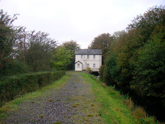
Detached three-bay two-storey former sluice keeper's house built c.1806, over Royal Canal supply line from Lough Owel. Projecting gable-fronted single-bay single-storey entrance porch to southeast corner. Pitched natural slate roof having central rendered chimneystack and cast-iron rainwater goods. Roughcast rendered walls to ground floor over projecting cut stone plinth with ruled-and-line rendered walls to first floor, separated by projecting cut stone string course. Cut stone quoins to corners of main building and projecting porch at ground floor level. Square-headed window openings having shallow cut stone sills and six-over-six pane timber sliding sash windows. Cast-iron security bars to ground floor openings. Square-headed doorcase to northeast side of porch having replacement timber door. Canal supply line runs under building (northwest to southeast) through segmental headed-arches having cut stone voussoirs to northeast side and rendered arch to southeast side. Sections of remaining cut stone masonry to water course channel. Timber and cast-iron sluice gates to northwest of house on upstream/headrace section. Footbridge over downstream/tailrace channel with cast-iron railings to southeast of building. Cut-stone kerbing on semi-circular plan north side of channel. Located adjacent to commencement of canal supply line adjacent to the southeast shores of Lough Owel. Remains of rubble stone outbuilding to southeast of the house. Rubble stone boundary wall runs parallel to approach road running southeast-northwest.
This official record and map point do not grant access. Most recorded buildings are privately owned; view them only from public ground unless the owner allows entry.