Add your own picture and explain the route, parking, gates, paths or landmarks that help people find it.
Earn 5 points after the picture is checked and accepted.
Add your photo and local directionsShare what you foundWhat is recorded here
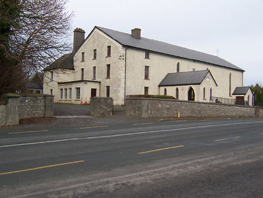
Freestanding three-bay double-height Roman Catholic church with adjoining single-bay three-storey parochial house to southwest end, built c.1844. Two-storey extension to southwest corner (rear) at right angle to parochial house with hipped slate roof and tall rendered chimneystack, c.1880. Two-bay single-storey entrance porch giving access to church on east facade and single-bay single-storey entrance porch to centre of south, giving access to parochial house. Modern single-bay single-storey porch to north end of east façade (church). Pitched artificial slate roof with overhanging eaves and a single rendered chimneystack to south end (over parochial house) and a wrought-iron cross finial to north end. Roughcast rendered walls with rendered eaves course and raised rendered quoins to corners. Pointed-arched openings with stained glass to church, square-headed openings with timber casement windows and cut stone sills to parochial house. One-over-one pane timber sliding sash windows to two-storey extension of parochial house (southwest). Pointed-arched openings to entrance porches to church and square-headed openings to porch serving parochial house. Cut stone plaque to east face of church reads 'Dedicated 1844, A McAlroy, Pastore'. Decorative cast-iron belfry to north of church and range of single-storey rubble limestone outbuildings to west. Rubble stone boundary wall with metal railings over to road frontage (east). Cut stone gate piers on square-plan to south end of road frontage.
This official record and map point do not grant access. Most recorded buildings are privately owned; view them only from public ground unless the owner allows entry.