Add your own picture and explain the route, parking, gates, paths or landmarks that help people find it.
Earn 5 points after the picture is checked and accepted.
Add your photo and local directionsShare what you foundWhat is recorded here
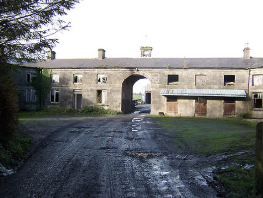
Ranges of multiple-bay two-storey stable block on U-shaped plan, built c.1808 or c.1824. Central integral carriage to southeast elevation with ashlar limestone bellcote over. Now in use as agricultural outbuildings. Hipped natural slate roofs with ashlar limestone chimneystacks. Constructed of ashlar limestone with ashlar trim, including projecting ashlar limestone string courses at first floor level and at eaves level. Projecting ashlar limestone plinth to base. Square-headed openings to exterior facades. Square-headed openings to ground floor in interior of courtyard with round-headed openings above to first floor, all set in full-height round-headed recesses. Mainly replacement window and door fittings throughout. Cast-iron lamp brackets to interior. Modern corrugated-iron canopies over stable doors to southwest range (interior). Located to the northwest of Ballynagall House (15401212) with remains of further outbuildings to northwest.
This official record and map point do not grant access. Most recorded buildings are privately owned; view them only from public ground unless the owner allows entry.