Add your own picture and explain the route, parking, gates, paths or landmarks that help people find it.
Earn 5 points after the picture is checked and accepted.
Add your photo and local directionsShare what you foundWhat is recorded here
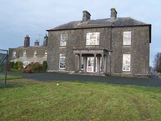
Detached three-bay two-storey house country house, built c.1810, with projecting single-bay entrance front with raised parapet over and a single-bay cut limestone tetrastyle Greek Ionic entrance porch the centre of the main façade (southeast). Five-bay two-storey service wing on L-shaped plan attached to the southwest having rendered finish to entrance front screening extensive stable block to the rear of the house (northwest). Hipped natural slate roof, arranged around central rotunda, having overhanging eaves, ashlar eaves cornice, cast-iron rainwater goods and four ashlar limestone chimneystacks having moulded cornices over. Constructed of squared and snecked punched limestone rubble over projecting chamfered ashlar limestone plinth. Square-headed window openings having cut stone sills and nine-over-six pane timber sliding sash windows to the ground floor openings and six-over-six pane timber sliding sash windows over to the first floor. Central Wyatt window to first floor over entrance porch. Segmental-headed window openings to service wing having architraved surrounds and replacement windows. Square-headed doorcase, behind entrance porch to southeast, having glazed timber double-doors. Doorcase flanked by narrow sidelights to either side having timber sliding sash windows. The return (south) of the 'L'-shaped service wing complex has a segmental-headed carriage arch, with dressed limestone voussoirs, leading into a cobbled kitchen yard beyond (north). To the east of this is a pointed-arch opening with intersecting Gothic tracery. Turbotstown House is set back from road in extensive mature grounds with substantial complex of outbuildings to the rear and the west (15400331), the remains of a walled garden to the west and main entrance gates and the remains of a gate lodge (15400332)to the south. Located to the northwest of Castlepollard and to the north of the village of Coole.
This official record and map point do not grant access. Most recorded buildings are privately owned; view them only from public ground unless the owner allows entry.