Add your own picture and explain the route, parking, gates, paths or landmarks that help people find it.
Earn 5 points after the picture is checked and accepted.
Add your photo and local directionsShare what you foundWhat is recorded here
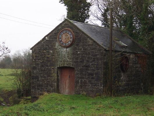
Detached single-bay gable-fronted former saw mill, built c.1865. Later in use as an electricity generating plant, c.1885. Now out of use. Pitched natural slate roof with raised rendered verges to either end and a single modern roof light to each side of roof (north and south). Constructed of coursed squared limestone rubble, almost snecked and rock-faced, with dressed limestone quoins to corners. Shallow segmental-headed carriage arch to west elevation having rock-faced limestone voussoirs over and timber double doors. Cast-iron clock face with Roman numerals, now missing hands, to gable above carriage arch to west. Two square-headed openings to east side of north facing elevation overlooking stream/millrace. Remains of sluice gate and steel and cast-iron machinery to west end of north elevation. Located to the south end of Streete.
This official record and map point do not grant access. Most recorded buildings are privately owned; view them only from public ground unless the owner allows entry.