Add your own picture and explain the route, parking, gates, paths or landmarks that help people find it.
Earn 5 points after the picture is checked and accepted.
Add your photo and local directionsShare what you foundWhat is recorded here
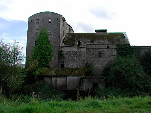
Corn mill complex, built c.1770 and extended c.1830, comprising main multiple-bay five-storey building on L-shaped plan, four-bay five storey mill and associated ancillary structures including the remains of a corn kiln to west. Now derelict and out of use. Roofs now gone, brick crenellated parapet with limestone coping over to main structure and barrel-vaulted corrugated metal roof to four-bay five-storey structure. Constructed mainly of rubble limestone with lime render over. Segmental-headed waterwheel opening to north side of north-facing building (possibly a corn store) with dressed limestone voussoirs. Flush dressed limestone quoins to corners of main building. Square-headed window openings remains of timber sliding sash and timber casement windows, cast-iron bars to ground floor windows. Ruins of three-bay single-storey building with pointed-arched windows and hoodmouldings over to south of main structure, possibly a mill worker's cottage. Set back from road in own grounds on south bank of River Brosna and to west of Coola Bridge. Remains of millrace and sluices to north running east-west. Rubble limestone boundary wall to west.
This official record and map point do not grant access. Most recorded buildings are privately owned; view them only from public ground unless the owner allows entry.