Add your own picture and explain the route, parking, gates, paths or landmarks that help people find it.
Earn 5 points after the picture is checked and accepted.
Add your photo and local directionsShare what you foundWhat is recorded here
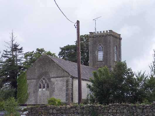
Freestanding Church of Ireland church, built c.1815, comprising two-bay hall with attached three-stage tower on square-plan to the west having a raised parapet with English-style crenellations. Now in use as a private house. Pitched natural slate roof with clay ridge tiles, cast-iron rainwater goods and raised cut stone verges to the gable ends (east and west). Roughcast rendered walls with raised cut stone quoins to the corners, cut stone string courses to the tower and a cut stone eaves course continued around the east gable end as a string course. Tower to the west constructed of rubble limestone with dressed limestone pilasters to the corners and having cut limestone crenellations over. Pointed-arched window openings to the nave having cut stone dressings, Y-tracery and diamond pane windows. Triple-light window to the east gable end having cut limestone dressings, cut limestone intersecting tracery and diamond paned windows. Pointed arched openings to belfry of tower having cut stone dressings and modern timber sash windows. Main entrance gates to the north having a pair of wrought-iron hooped gates. Rendered boundary wall with cast-iron railings over to the road frontage (north). Cast-iron date plaque to the east end of the boundary wall to the north. Rubble limestone boundary wall to the south. Set back from road in own grounds to the south side of the centre of Rochfortbridge.
This official record and map point do not grant access. Most recorded buildings are privately owned; view them only from public ground unless the owner allows entry.