Add your own picture and explain the route, parking, gates, paths or landmarks that help people find it.
Earn 5 points after the picture is checked and accepted.
Add your photo and local directionsShare what you foundWhat is recorded here
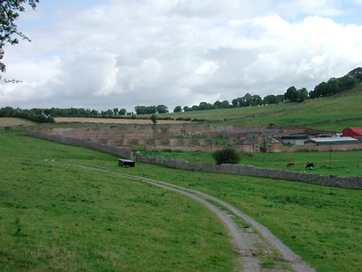
Extensive complex of walled gardens on rectangular plan associated with Waterstown House (15314014), built c.1750, having a pedimented gateway to the centre of the south facing elevation. Now in use as a farmyard. Walled garden is divided into a number of sections by internal party walls, some of with infilled brick arcades and others have segmental recesses along length creating a 'corrugated' profile in plan. Outer walls constructed with rubble limestone and lined internally with brick. Inner walls and dividing walls constructed or lined by brick. Main entrance gate to the centre of the south elevation comprises a pedimented round-headed carriage arch with projecting keystone, brick cornice and raised brick block-and-start surrounds. Pediment pierced by a Diocletian opening with projecting keystone and raised brick block-and-start surrounds. Main entrance flanked to either side (east and west) by sections of brick wall with segmental-headed pedestrian entrances and terminated by single-storey brick pavilions with hipped slate roofs. Located to the northeast of the remains of Waterstown House (15314014) on a gentle south-facing slope.
This official record and map point do not grant access. Most recorded buildings are privately owned; view them only from public ground unless the owner allows entry.