Add your own picture and explain the route, parking, gates, paths or landmarks that help people find it.
Earn 5 points after the picture is checked and accepted.
Add your photo and local directionsShare what you foundWhat is recorded here
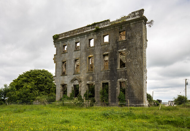
Detached seven-bay three-storey over basement Palladian style country house on rectangular plan, constructed c.1745. Now a roofless, derelict and partially collapsed shell. Originally had a shallow hipped roof hidden behind a high parapet with a moulded cut stone eaves cornice, roof now collapsed. Constructed of ashlar limestone (over brick and limestone rubble core) with ashlar limestone trim including a projecting chamfered ashlar string course separating the basement level from the ground floor. Rubble limestone construction to basement. Square-headed window openings with cut stone sills, cut stone Gibbsian surrounds to ground floor and with cut stone lugged surrounds above to first and second floor openings. Segmental-headed openings with cut stone surrounds having projecting keystones to basement level. Waterstown originally had a pedimented doorcase to the centre of the north elevation, removed in 1928. Sunken courtyard and stores survive to east side and rubble limestone tunnel leads from basement towards farm buildings (15314001) on west side. Interior now gutted but evidence of early plaster panelling to stair hall, corner fireplaces and timber floor joists remain. Underground brick chambers lead to basement. Located in prominent position to the southeast of the village of Glassan in rolling mature grounds, now in use as farmland.
This official record and map point do not grant access. Most recorded buildings are privately owned; view them only from public ground unless the owner allows entry.