Add your own picture and explain the route, parking, gates, paths or landmarks that help people find it.
Earn 5 points after the picture is checked and accepted.
Add your photo and local directionsShare what you foundWhat is recorded here
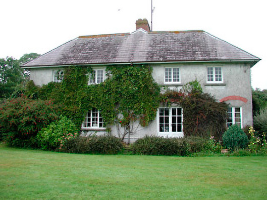
A pair of semi-detached two-bay two-storey estate workers' houses, built c.1880, originally in use as a groom’s house and gardener’s house associated with Joristown House (15313001). Now converted into a single property and in use as a private house having a modern extension to the rear (north). Hipped natural slate roof with a (shared) red brick chimneystack to the centre and having cast-iron rainwater goods. Square-headed window openings with lintels over and multi-pane timber casement windows. Square-headed door openings with replacement timber doors. red brick relieving arches over a number of the window and door openings. Single-storey stable block to the rear (north) having hipped timber shingle roof and timber sheeted walls. Gateway with wrought-iron gate gives access to stable block from the house. Building surrounded by the remains of a former walled garden, having red brick internal walls and rubble limestone external construction. Wrought-iron field gate to the north of stable block with interlacing flat bars. Located to the north of Joristown House (15313001) and to the west of Raharney.
This official record and map point do not grant access. Most recorded buildings are privately owned; view them only from public ground unless the owner allows entry.