Add your own picture and explain the route, parking, gates, paths or landmarks that help people find it.
Earn 5 points after the picture is checked and accepted.
Add your photo and local directionsShare what you foundWhat is recorded here
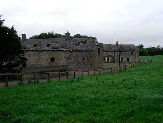
Detached multi-bay two-storey house/farmhouse, built c.1795, having a single-bay flat-roofed entrance porch to the centre of the front façade (west). Outbuildings to the west and to the north creating a courtyard on U-shaped plan. Now out of use and derelict. Half-hipped natural slate roof (graded with larger slates to lower courses) with a pair of rendered chimneystacks and cast-iron rainwater goods. Terracotta pots over chimneystack to the north. Roughcast rendered walls over rubble stone construction. Smooth rendered plinth to base. Square-headed window openings, irregularly spaced, with cut stone sills and two-over-two pane timber sliding sash windows. Wyatt window to front face of porch (east). Square-headed doorways to the north face of porch and to the south end of main façade (east) having timber sheeted doors. Detached four-bay two-storey outbuilding to the west, aligned along alignment of former house/farmhouse, having half-hipped hipped natural slate roof with rendered chimneystacks. Randomly coursed rubble stone walls with roughly dressed quoins to the corners. Date inscribed to one the quoins to the southeast corner of building, reading ‘Anno Domini 1795’. Square-headed window openings to east and west elevations with brick dressings and cut stone sills. Window fittings now gone. Segmental-headed window openings with dressed stone surrounds to the south gable end at first floor level. Square-headed integral carriage arches and square-headed doorcases to the east elevation with the remains of timber sheeted doors/double-doors having overlights above. Single-storey former stable range to the north, having corrugated metal mono-pitched roofs and timber sheeted walls having square-headed doorways with timber sheet doors. Rubble stone boundary wall to the rear of stable ranges having an integral segmental-headed carriage arch to the centre with dressed limestone voussoirs. Set well back from road in own grounds, shared with modern farmyard to the west. Located to the west of Raharney.
This official record and map point do not grant access. Most recorded buildings are privately owned; view them only from public ground unless the owner allows entry.