Add your own picture and explain the route, parking, gates, paths or landmarks that help people find it.
Earn 5 points after the picture is checked and accepted.
Add your photo and local directionsShare what you foundWhat is recorded here
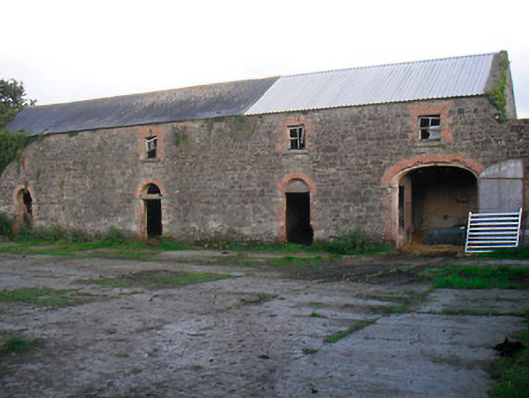
Collection of single and double-storey outbuildings formerly part of Curristown House (now ruinous or demolished), built c.1800 and 1850, arranged around two separate courtyards. Now in use as agricultural outbuildings/farmyard. Pitched natural slate roofs, some sections now partially covered with corrugated metal sheeting, having remaining sections of cast-iron rainwater goods. Two-storey ranges (north) constructed of coursed rubble limestone with brick dressings to openings. Roughcast lime rendered finish to single-storey ranges (south). Square-headed window and door openings and segmental-headed carriage arches, with remains of timber sliding sash windows and timber sheeted doors. Remains of dressed limestone gate piers on square-plan give access to courtyards. Rubble limestone gate piers on circular plan to site, the majority having wrought-iron bar gates, give access to fields to north and to the east. Possible remains of Curristown House to the southwest corner of complex. Complex located on the eastern edge of Killucan.
This official record and map point do not grant access. Most recorded buildings are privately owned; view them only from public ground unless the owner allows entry.