Add your own picture and explain the route, parking, gates, paths or landmarks that help people find it.
Earn 5 points after the picture is checked and accepted.
Add your photo and local directionsShare what you foundWhat is recorded here
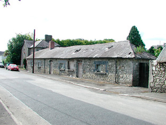
Group of four houses/buildings, comprising a semi-detached three-bay two-storey house to the east with a projecting gable-fronted breakfront to the centre bay, built c.1880, and a group of terraced three-bay single-storey houses to the west, built c.1820. Two-storey building previously in use as a post office (c.1914) and a number of the single-storey buildings were formerly in use as a bakery. Single-storey houses now out of use. Two-storey building still occupied. Hipped and pitched natural slate roofs to two-storey house having a central brick chimneystack and cast-iron rainwater goods. Hipped natural slate roof (pitched to west end) to single-storey houses having cast-iron rainwater goods and with a modern brick chimneystack towards the east end. Two-storey building constructed of coursed limestone with brick dressings to the openings and brick quoins to the corners. Random rubble limestone construction to the single-storey terrace with dressed stone quoins to the corners and cut limestone dressings to the openings. Square and segmental-headed window openings to two-storey building with stone sills and timber sash windows. Segmental-headed window openings to single-storey terrace with cut stone sills and with a number of remaining (paired) timber casement windows. Window openings to the west end now most blocked. Segmental-headed doorcases, mostly blocked to the single-storey range. Two-storey structure is set back from road and bounded on road frontage by iron railings and gate. Single-storey terrace is road-fronted.
This official record and map point do not grant access. Most recorded buildings are privately owned; view them only from public ground unless the owner allows entry.