Add your own picture and explain the route, parking, gates, paths or landmarks that help people find it.
Earn 5 points after the picture is checked and accepted.
Add your photo and local directionsShare what you foundWhat is recorded here
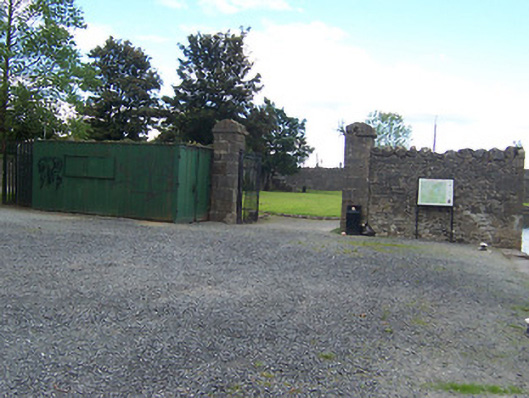
Section of rubble limestone boundary walling associated with a former Royal Canal storage yard, erected c.1806. Now surrounds a public park with former stores now demolished. Main gateway to the west end through a pair of ashlar limestone gate piers (on square-plan) having moulded capstones over and supporting wrought-iron gates. Located adjacent to the north of the former Royal Canal (passenger) Harbour (15310150) and to the west of Scanlan's Bridge (15310151).
This official record and map point do not grant access. Most recorded buildings are privately owned; view them only from public ground unless the owner allows entry.