Add your own picture and explain the route, parking, gates, paths or landmarks that help people find it.
Earn 5 points after the picture is checked and accepted.
Add your photo and local directionsShare what you foundWhat is recorded here
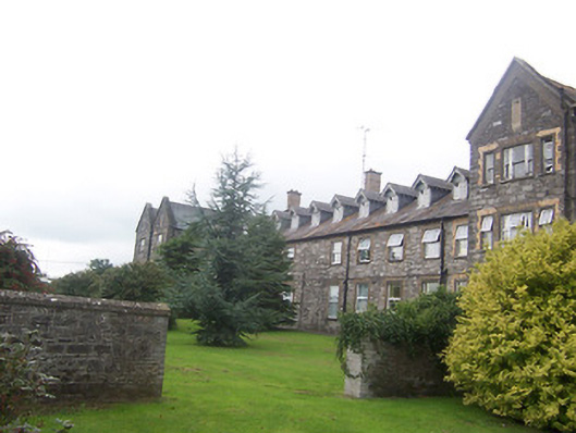
Former union workhouse complex on H-shaped plan, built c.1841, comprising a thirteen-bay two-storey range (having attic storey with dormers to roof) with three-storey double gable-fronted end blocks to the southwest and northeast. Further two and three-storey blocks, one containing a chapel, and detached buildings to the rear, some derelict. Now in use as a hospital. Pitched natural slate roofs with overhanging eaves, timber bargeboards to gable-fronted sections and brick chimneystacks. Raised limestone verges to gable ends of three-storey blocks. Constructed of coursed limestone rubble over cut stone plinth with brick or cut stone dressings to the openings. Square-headed window openings with a number of surviving sash windows but mostly with replacement windows. Tripartite timber sash windows to gable-fronted three-storey blocks. Square-headed door openings now mostly having replacement doors. Located to the rear (northwest) of the former workhouse administration block (15309008) and to the north of Mullingar. Former workhouse graveyard to the northeast (15309019).
This official record and map point do not grant access. Most recorded buildings are privately owned; view them only from public ground unless the owner allows entry.