Add your own picture and explain the route, parking, gates, paths or landmarks that help people find it.
Earn 5 points after the picture is checked and accepted.
Add your photo and local directionsShare what you foundWhat is recorded here
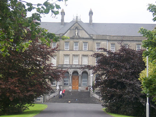
Detached twenty-one bay three-storey over basement former Roman Catholic seminary, built between 1902 and 1908, having a central three-bay pedimented breakfront and three-bay breakfronts to either end (east and west). Open three-bay single-storey porch served by a splayed flight of cut stone steps flanked by parapet walls to main entrance. Three-storey over basement returns to rear (north) and a chapel (15309013) to the east. Now in use as a boy’s secondary school. Steeply pitched and hipped natural slate roofs, rising behind a corniced parapet, and having rendered chimneystacks with limestone trim. Wrought-iron railings over roof to central breakfront. Constructed of rusticated limestone to the basement with channelled cement rendered finish to the ground floor and smooth cement render finish over to second and third. Moulded string course at first floor level and a cut stone string course at third floor level. Round-headed windows to ground floor with linking string course at springing point. Square-headed window openings with replacement metal casement windows to other floors. Basement windows have metal bar grills. Central round-headed doorcase to arcaded porch with timber double doors having a plain fanlight over. Set back from road in extensive mature grounds with main entrance to the southeast (15309011) and a detached gymnasium (15309014) to the rear (north). Located to the north of Mullingar.
This official record and map point do not grant access. Most recorded buildings are privately owned; view them only from public ground unless the owner allows entry.