Add your own picture and explain the route, parking, gates, paths or landmarks that help people find it.
Earn 5 points after the picture is checked and accepted.
Add your photo and local directionsShare what you foundWhat is recorded here
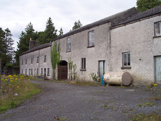
Complex of multi-bay two-storey complex of outbuildings arranged on an L-shape plan, c.1820 and possibly incorporating earlier fabric. Single-storey farm outbuildings to the south, comprising a cattle shed, hen house and ancillary structures. Now in use as storage facilities for adjacent hospital. Hipped and pitched natural slate roofs with clay ridge tiles having sections of surviving cast-iron rainwater goods. Roughcast rendered walls over rubble stonework construction. Square-headed window and door openings having replacement windows and a number of early timber sheeted doors. Cut stone sills to a number of the window openings. Large segmental-headed carriage arch towards centre of northeast facing range. Located to the southwest of Kinturk House (15302016) and to the south of Castlepollard.
This official record and map point do not grant access. Most recorded buildings are privately owned; view them only from public ground unless the owner allows entry.