Add your own picture and explain the route, parking, gates, paths or landmarks that help people find it.
Earn 5 points after the picture is checked and accepted.
Add your photo and local directionsShare what you foundWhat is recorded here
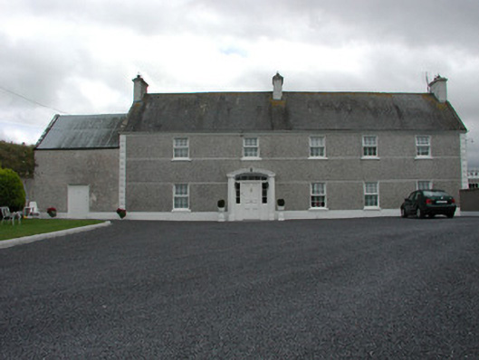
Detached five-bay two-storey farmhouse built c.1820, with two-storey outbuilding to abutting east gable and single-storey extension to west. Pitched slate roof with ruled-and-lined rendered chimneystacks and cast-iron rainwater goods. Pebbledash, smooth rendered plinth and string courses with diamond pointed quoins to façade. Smooth rendered plinth and roughcast render to side and rear elevations. Replacement uPVC windows with painted sills. Stilted segmental-headed door opening with pebbledash to keystone, moulded stucco surround, panelled door and stained glass overlight and side lights. Two-storey roughcast rendered outbuilding to abutting east gable with corrugated-iron roof and timber battened door. Single-storey extension to west with concrete balustrade to parapet. Single-storey agricultural outbuilding to north with hipped corrugated-iron roof and roughcast rendered walls. Walled garden to north of outbuilding with random coursed walls, square-profile gate piers and segmental-headed carriage arch opening.
This official record and map point do not grant access. Most recorded buildings are privately owned; view them only from public ground unless the owner allows entry.