Add your own picture and explain the route, parking, gates, paths or landmarks that help people find it.
Earn 5 points after the picture is checked and accepted.
Add your photo and local directionsShare what you foundWhat is recorded here
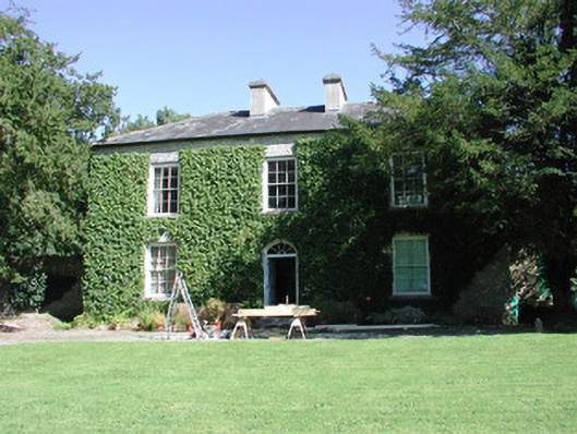
Detached three-bay two-storey miller's house, built c.1850, with lean-to single-storey porch to northern gable. Set within its own grounds with derelict mill to north. Hipped slate roof with terracotta ridge tiles and smooth rendered chimneystacks. Lean-to corrugated iron roof to rear porch. Roughcast rendered walls with tooled stone eaves course and replacement rainwater goods. Timber sash window with stone sills. Round-headed door opening with spoked timber fanlight and replacement timber panelled door with stone step. Square-headed door opening to porch with timber panelled door. Square-headed door opening to rear with new glazed timber doors. Ruinous two-storey outbuilding to rear with external stone steps to gable. Walled garden to south with random coursed walls, accessed from front site through timber battened door and from north through segmental-headed carriage arch opening. Derelict mill and yard to north. Circular-profile stone gate piers access garden to front site with wrought-iron gate. Circular-profile stone piers with wrought-iron gate access driveway to front site. Wrought-iron gate set between north gable of house and south gable of adjacent mill, accessing rear yard. Bridge straddling stream which cuts driveway, having roughly hewn voussoirs, no parapets and cobbles to surface. Square-profile rendered gate piers to road with wrought-iron gate and rendered caps.
This official record and map point do not grant access. Most recorded buildings are privately owned; view them only from public ground unless the owner allows entry.