Add your own picture and explain the route, parking, gates, paths or landmarks that help people find it.
Earn 5 points after the picture is checked and accepted.
Add your photo and local directionsShare what you foundWhat is recorded here
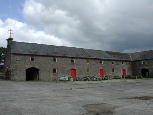
Farmyard complex to Mount Butler, built c.1810, comprising L-plan range of two-storey outbuildings to north-east of yard, single-storey former animal byres to south and a small stable yard with coach house to west. Mount Butler no longer survives. Pitched and half-hipped slate roofs with cast-iron rainwater goods. Random coursed limestone and sandstone walls with some remains of lime render. Variety of window and door openings. Limestone piers support brick arches to byres. Stable yard accessed through pedimented arched opening flanked by screen walls with blind arches. Two-storey coach house with ashlar limestone carriage arch is flanked by twin round-headed door openings. Cast-iron former entrance gates and railings to Mount Butler survive to roadside.
This official record and map point do not grant access. Most recorded buildings are privately owned; view them only from public ground unless the owner allows entry.