Add your own picture and explain the route, parking, gates, paths or landmarks that help people find it.
Earn 5 points after the picture is checked and accepted.
Add your photo and local directionsShare what you foundWhat is recorded here
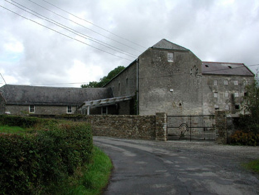
Detached L-plan multiple-bay three- and four-storey mill, built c.1820, with two-storey range to west. No longer in use. Located north of miller's house and powered by a tributary of the River Barrow. Constructed in phases. Pitched and half-hipped slate roofs with some cast-iron rainwater goods. Terracotta ridge cresting to principle mill building to north. Random coursed limestone and sandstone walls with remnants of roughcast render. Square-headed window openings with limestone flat arches and yellow brick reveals, some with timber sash windows. Flat arched door openings to mill with some decorative ogee-headed door openings with yellow brick reveals. Modern weighthouse and platform to south of yard. Yard enclosed by random coursed stone wall and accessed through carriage arch openings.
This official record and map point do not grant access. Most recorded buildings are privately owned; view them only from public ground unless the owner allows entry.