Add your own picture and explain the route, parking, gates, paths or landmarks that help people find it.
Earn 5 points after the picture is checked and accepted.
Add your photo and local directionsShare what you foundWhat is recorded here
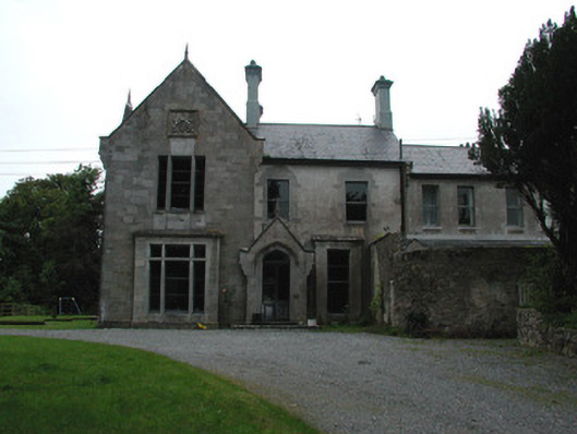
Detached Jacobean style country house, built c.1870, incorporating earlier house visible from the rear and built on the site of Cangort Castle, destroyed in the seventeenth century. Three-bay two-storey principal elevation with projecting gabled bay and gabled entrance porch. South-facing side elevation has gabled end bays. Pitched slate roofs with tall rendered chimneystacks with moulded brick cornices. Punched ashlar limestone south-facing elevation and to projecting gables to front and rear elevations with heraldic plaques, corbelled eaves course and surmounted by finials. Ruled-and-lined render to remaining elevations. Square-headed window openings to front and south-facing side elevations with box-bay windows with transom and mullion windows to ground floor and square-headed mullion windows to first floor. Round-headed window openings to rear elevation with timber sash windows. Square-headed window openings elsewhere with timber sash windows and limestone sills. Tudor arched door opening to gabled entrance porch with limestone hoodmoulding and timber and glazed door. Ranges of single- and two-storey outbuildings in yard to north of house. Walled garden to north-west of house with random coursed walls. Ruined three-bay single-storey structure to rear of walled garden with pointed-arched door opening. Site accessed through decorative cast-iron gates and railings to road.
This official record and map point do not grant access. Most recorded buildings are privately owned; view them only from public ground unless the owner allows entry.