Add your own picture and explain the route, parking, gates, paths or landmarks that help people find it.
Earn 5 points after the picture is checked and accepted.
Add your photo and local directionsShare what you foundWhat is recorded here
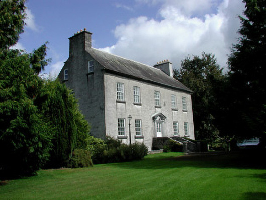
Detached L-plan five-bay three-storey over basement country house, built c.1770, with extensions to rear. Basement area to front of house enclosed behind plinth wall. Pitched slate roof with rendered chimneystacks and cast-iron rainwater goods. Roughcast rendered walls with tooled limestone cornice. Square-headed window openings with timber sash windows and tooled limestone sills. Square-headed door opening with open-bed pedimented surround with Doric pilasters. R.P 177 engraved above door. Door accessed up seven limestone steps flanked by walls terminating in limestone piers. Partially cobbled rear yard accessed through arched opening surmounted by bellcote. L-plan range of outbuildings and stables to rear yard with incorporating three-storey former malting house to east. Partially uncovered date stone to outbuildings - 1773. Former pigery to rear of house. Walled orchard to west of house. Three-bay gate lodge to road with hipped roof. Wrought-iron entrance gates supported by rendered piers and flanked by quadrant walls. Site enclosed by random coursed walls.
This official record and map point do not grant access. Most recorded buildings are privately owned; view them only from public ground unless the owner allows entry.