Add your own picture and explain the route, parking, gates, paths or landmarks that help people find it.
Earn 5 points after the picture is checked and accepted.
Add your photo and local directionsShare what you foundWhat is recorded here
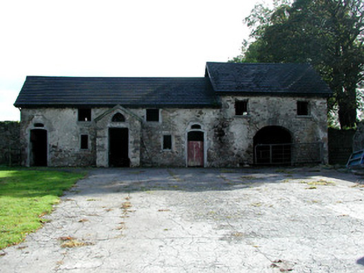
Ranges of farm buildings, built c.1830, situated to east of Strawberry Hill and with walled garden to south. Southern range with pitched slate roof, corrugated and slate roof to northern range with cast-iron rainwater goods. Roughcast render to both ranges covering random coursed stone walls. Window openings with stone sills. Square-headed door openings to southern range. Central opening within projecting brick porch and surmounted by segmental-headed overnights. Segmental-headed carriage arch with stone visors within southern range. Northern range with square-headed carriage arch within projecting porch with timber battened double doors and pointed-arched overnight within timber battening. Random coursed walled garden to south accessed through segmental-headed carriage arch. Site bounded by random coursed wall accessed through timber battened gates with square-profile gate piers and round-headed pedestrian entrance with rustic grotesque surround and wrought-iron gate.
This official record and map point do not grant access. Most recorded buildings are privately owned; view them only from public ground unless the owner allows entry.