Add your own picture and explain the route, parking, gates, paths or landmarks that help people find it.
Earn 5 points after the picture is checked and accepted.
Add your photo and local directionsShare what you foundWhat is recorded here
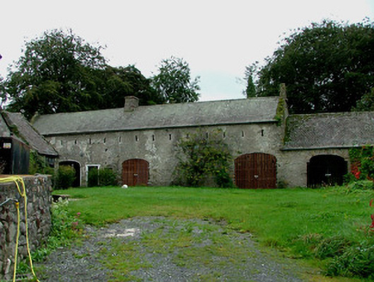
Ranges of multiple-bay single- and two-storey domestic outbuildings, built c.1740, to the rear site of a modernised detached L-plan multiple-bay two-storey house to north. Site bounded by rendered random coursed wall. Pitched slate roofs with terracotta ridge tiles and stone chimneystacks. Lime washed random coursed walls with cast-iron tie-bar plates. Window openings with timber battened shutters and stone sills. Slit vents to upper storey of south range. Square-headed door openings with timber battened doors and overlights to some. Segmental-headed carriage arches, some with replacement timber gates. Segmental-headed integral carriage arch in south range giving access to rear laneway. Hipped and pitched pan-tiled roof to house with roughcast render to walls and replacement windows. Rear of house faces road. Site bounded by part-rendered random coursed wall, lime-washed to interior, crenellated in parts, battered to north and buttressed to west. Wrought-iron pedestrian gate set to round-arched opening with limestone steps and wrought-iron railings. Round-arched vehicular gateway with corrugated-iron gate and square-headed pedestrian gate to west.
This official record and map point do not grant access. Most recorded buildings are privately owned; view them only from public ground unless the owner allows entry.