Add your own picture and explain the route, parking, gates, paths or landmarks that help people find it.
Earn 5 points after the picture is checked and accepted.
Add your photo and local directionsShare what you foundWhat is recorded here
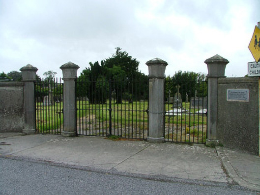
Boundary wall and gates to graveyard and site of demolished Catholic Church, erected c.1810. Rendered stone wall with tooled coping stones, flanking tooled octagonal limestone piers raised on plinths with moulded bands and pointed caps. Wrought-iron vehicular gates flanked by pedestrian gates. Modern plaque to wall commemorating victims of the mid nineteenth-century famine. Upright and recumbent stone grave markers to graveyard. Upright grave markers have been relocated to southern boundary wall. Terracotta floor tiles of demolished church, built in 1808 and demolished in 1971, in situ to centre of graveyard.
This official record and map point do not grant access. Most recorded buildings are privately owned; view them only from public ground unless the owner allows entry.