Add your own picture and explain the route, parking, gates, paths or landmarks that help people find it.
Earn 5 points after the picture is checked and accepted.
Add your photo and local directionsShare what you foundWhat is recorded here
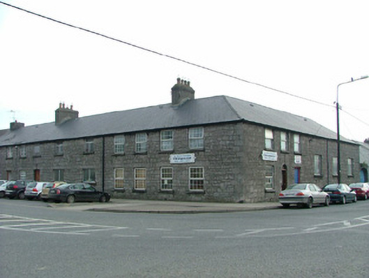
End-of-terrace corner-sited multiple-bay two-storey former school built by the Earl of Charleville in 1811, now in multiple uses with carriage arch to south-east. Fronting directly onto street. Hipped tiled roof with rendered chimneystacks. Random coursed limestone walls with tooled stone quoins. Modern limestone date plaque inserted to former blocked up opening reading: 'Charleville National School, 1870'. UPVC windows with tooled limestone sills and limestone flat arches. Round-headed door opening on south elevation with tooled limestone arch, limestone steps and replacement glazed timber door and fanlight. Three square-headed door openings with timber battened doors, replacement timber door and limestone step. Segmental-headed carriage arch to south with tooled limestone carriage arch to south-east with tooled limestone surround and corrugated-iron gates. Random coursed stone wall bounds rear of site.
This official record and map point do not grant access. Most recorded buildings are privately owned; view them only from public ground unless the owner allows entry.