Add your own picture and explain the route, parking, gates, paths or landmarks that help people find it.
Earn 5 points after the picture is checked and accepted.
Add your photo and local directionsShare what you foundWhat is recorded here
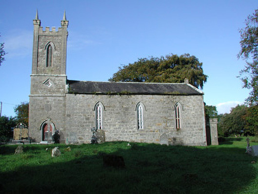
Detached former Church of Ireland church, built c.1820, with three-bay nave, three-stage tower to south and vestry to north. Situated within its own grounds. Church is no longer in use. Pitched slate roof with terracotta ridge tiles and chimneystack over northern gable. Random coursed stone walls with tooled stone plinth course. String courses to tower with pinnacles and crenellations. Crenellations to parapet of vestry. Pointed-arched window openings to nave with Y-tracery and diamond-paned glazing bars. Diamond-shaped window openings with hoodmouldings to central stage of tower. Pointed-arched louvred openings to belfry with hoodmouldings. Square-headed window opening to vestry with tooled stone surround, hoodmoulding and diamond-paned windows. Pointed-segmental chancel window with Y-tracery. Pointed-arched door opening to tower with tooled stone surround, hoodmoulding, timber blind tracery panelled double doors and stone threshold. Pointed-arched door opening to vestry with timber battened door. Church set within graveyard with variety of stone grave markers. Enclosed private burial plot to west of church, bounded by random coursed stone wall with tooled coping and accessed though flat-arched portal opening with wrought-iron gate. Tower of church is flanked by sweeping wrought-iron railings set on a tooled stone plinth with gates, which bound graveyard to south.
This official record and map point do not grant access. Most recorded buildings are privately owned; view them only from public ground unless the owner allows entry.