Add your own picture and explain the route, parking, gates, paths or landmarks that help people find it.
Earn 5 points after the picture is checked and accepted.
Add your photo and local directionsShare what you foundWhat is recorded here
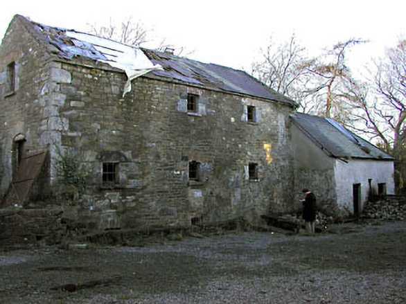
Three-storey three-bay water-powered corn mill, built c.1820, probably incorporating the fabric of an earlier mill building. Built of randomly coursed limestone with large dressed quoins to corners and projecting masonry eaves course. Pitched roof with natural slate now in poor condition. Entrance on east side is partially sunk into ground and is reached via flight of stone steps. This sunken entrance forms part of a gully/drain which was used to take water away from closed sluice gate, around mill and out under later extension to north and into tail race. Windows to east façade have square-headed brick openings with iron security bars and remains of timber sash windows. Wide entrance with segmental-headed opening built of dressed limestone located on first floor of south gable. Remains of timber and iron waterwheel, c. 12 feet in diameter located on south end of east façade. Remains of timber trough and sluice gate indicate that waterwheel was overshot by water directed under road. Remains of four millstones (sandstone) and varierty of iron cogs, sieves to mill interior, now in poor repair. An extension is located to the north appears to have been constructed partially of compacted earth. A detached two-bay two-storey grain drying kiln built of randomly coursed limestone with a timber louvred vent built into roof is located to the south east.
This official record and map point do not grant access. Most recorded buildings are privately owned; view them only from public ground unless the owner allows entry.